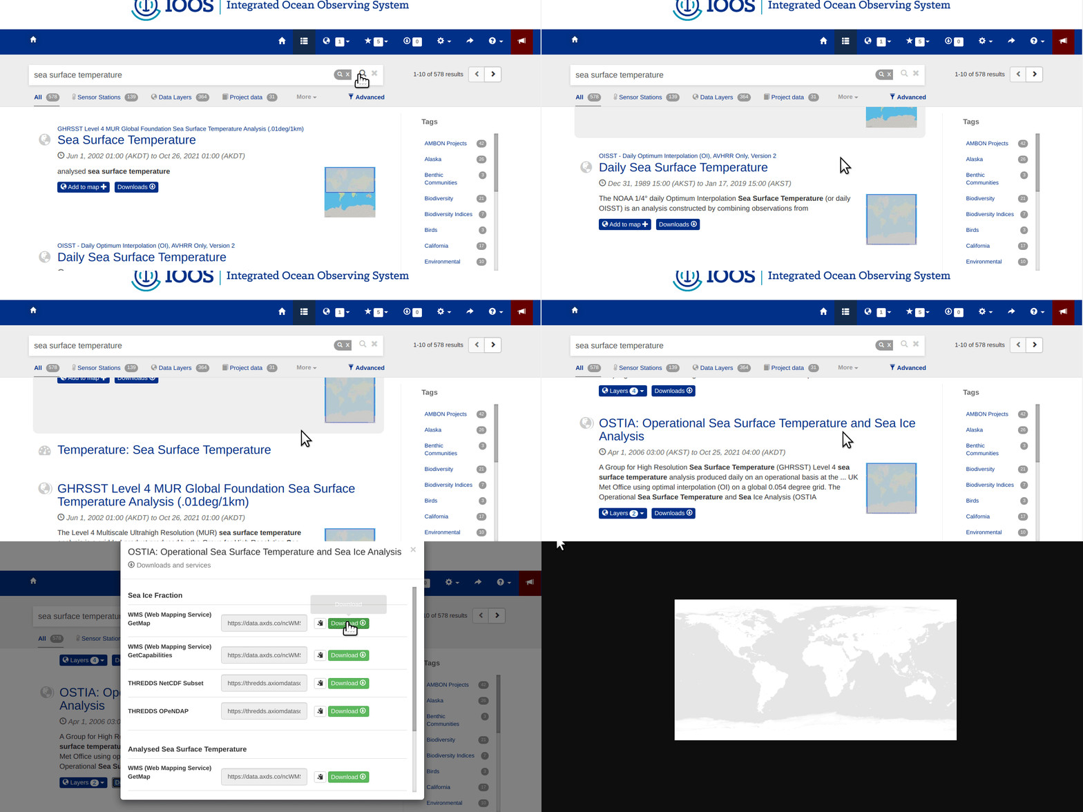
Download Using WMS

Click on the Download button
 .
.Select
WMS (Web Mapping Service).The service will open in a new browser tab and the results will display.
The returned image will be projected according to the parameters set in the URL. For example:
Modifying the parameters (e.g., changing the WIDTH, COLORSCALERANGE values, or the projection and reloading the page will redraw the image for your mapping service.
For more information, please see the Gridded Data section.